


Millard Fillmore, Collector of Maps, Thanks the Head of the Corps of Topographical Engineers for Sending Him New Charts and a Collection of Tables Useful in Surveying and the Projection of Maps


- Currency:
- USD
- GBP
- JPY
- EUR
- CNY
 This currency selector is for viewing only.
The Raab Collection only accepts USD payments at checkout.
Exchange rates are updated hourly. Rates may be inaccurate.
The Army Corps of Topographical Engineers was responsible for mapping and engineering, and for the design and construction of federal civil works such as lighthouses and other coastal fortifications and navigational routes. Members included such officers as George G. Meade and John C. Fremont. Col. John James Abert was a U.S. Army...


The Army Corps of Topographical Engineers was responsible for mapping and engineering, and for the design and construction of federal civil works such as lighthouses and other coastal fortifications and navigational routes. Members included such officers as George G. Meade and John C. Fremont. Col. John James Abert was a U.S. Army officer who headed the Corps for 32 years, during which time he supervised many early national engineering projects. He also organized the mapping of the American West. Working with him was Col. T.J. Lee, who in 1849 wrote “A Collection of Tables and Formulae Useful in Surveying, Geodesy, and Practical Astronomy: Including Elements for the Projection of Maps”. This was prepared for specifically for the use of the Corps of Topographical Engineers. Between 1849-1853, that Corps produced three charts of Lake Erie, which were among the first charts published by the Lake Survey. The charts were prepared under the direction of Lee, and finally became available in 1853.
Millard Fillmore was president during the 1849-1853 period, and he was known to have an interest in the work of the Topographical Engineers. He was a collector of maps, and some of the maps from this era in the Library of Congress have his signature on the verso. He also delivered messages to Congress about the work of the Topographical Engineers.
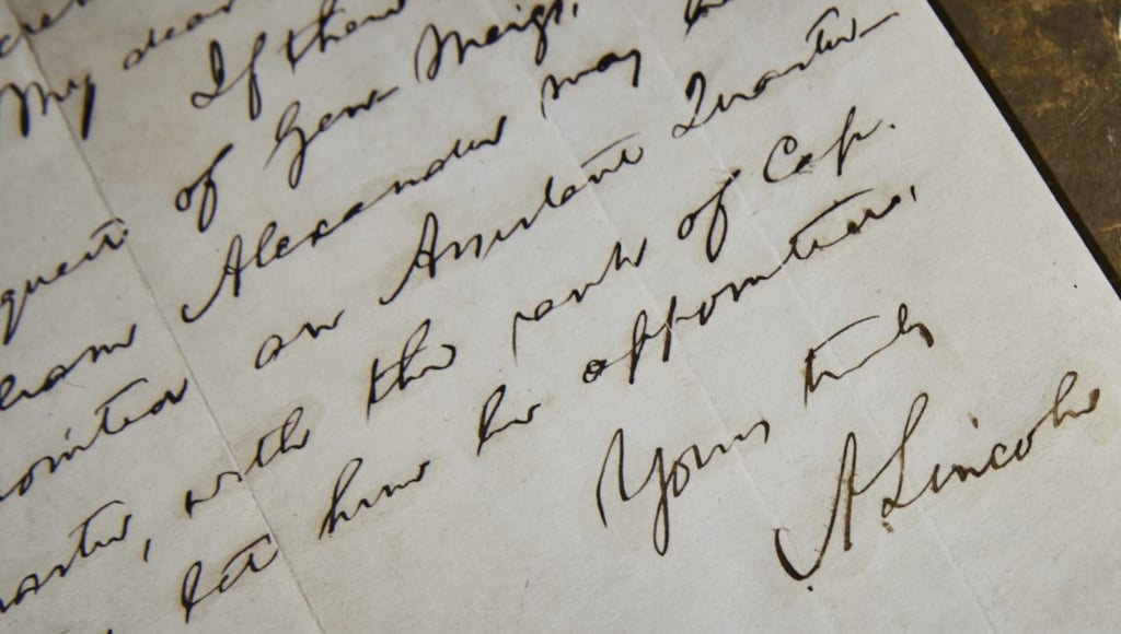
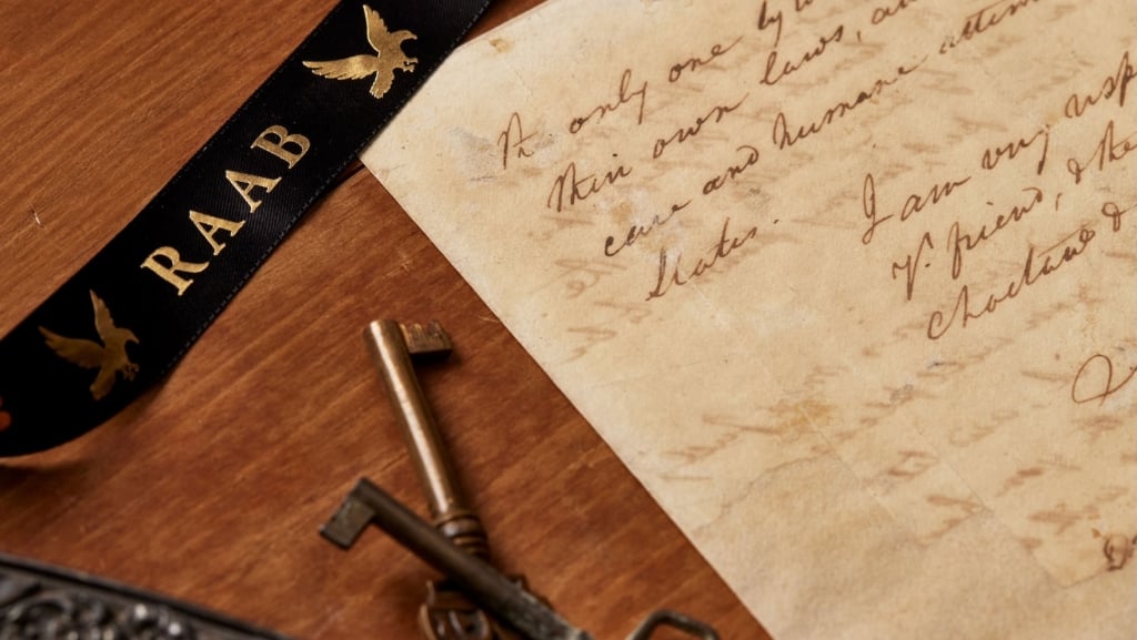
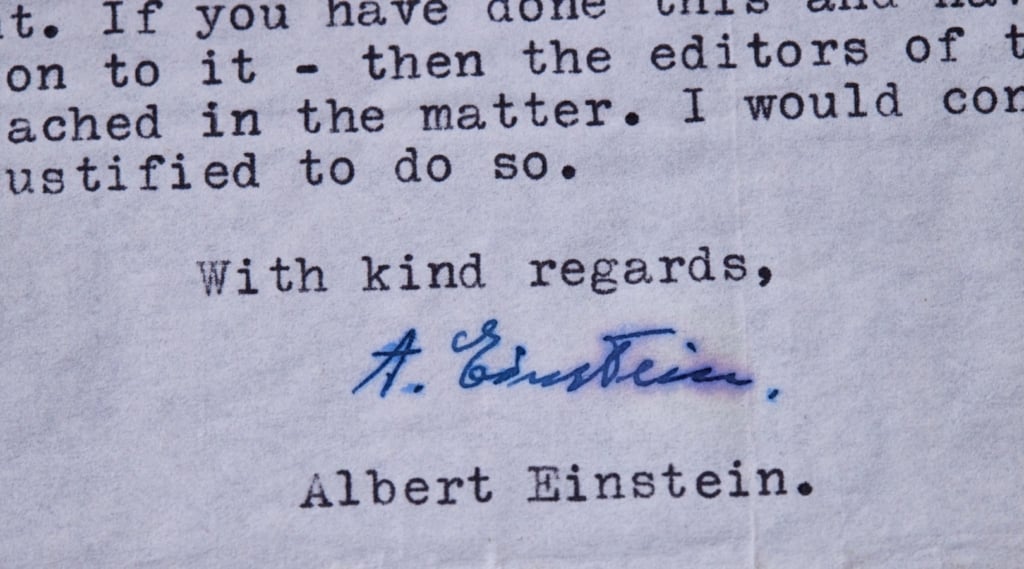
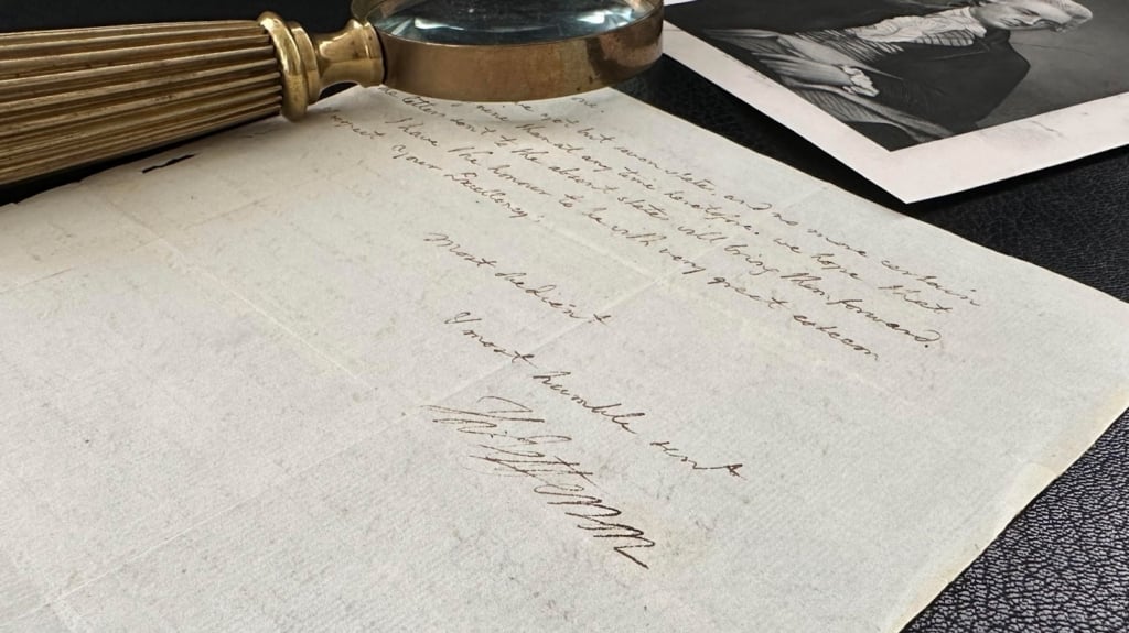
Autograph letter signed, Buffalo, October 7, 1853, just seven months after leaving the White House, to Abert in Washington. “Accept my thanks for the duplicate copies of the charts of Lake Erie, which you were so kind as to send me, and which arrived in good order last evening, and also for a copy of Capt. Lee’s Tables and Formulae.”
It is interesting to know that Fillmore was a collector, and that friends in government were sending him things for his collection even after he left office.

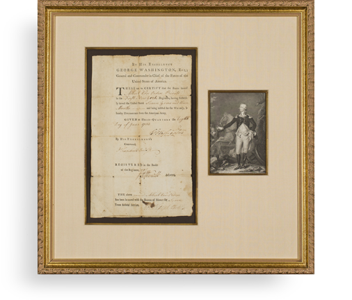
Frame, Display, Preserve
Each frame is custom constructed, using only proper museum archival materials. This includes:The finest frames, tailored to match the document you have chosen. These can period style, antiqued, gilded, wood, etc. Fabric mats, including silk and satin, as well as museum mat board with hand painted bevels. Attachment of the document to the matting to ensure its protection. This "hinging" is done according to archival standards. Protective "glass," or Tru Vue Optium Acrylic glazing, which is shatter resistant, 99% UV protective, and anti-reflective. You benefit from our decades of experience in designing and creating beautiful, compelling, and protective framed historical documents.
Learn more about our Framing Services
