


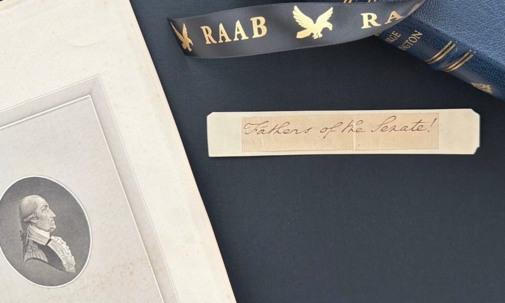


Sold – To the Halls of Montezuma

The Original Chart of Directions For the United States Army to Reach Mexico City in the Mexican War, in the hand of the army’s foremost topographical engineer, Robert E. Lee .
After the Mexican War broke out, army engineer Robert E. Lee reported to General John Wool at San Antonio de Bexar, Texas on September 21, 1846. Within days, he and his fellow topographical engineers set out to find the best route for Wool’s advance in the Chihuahuan Expedition, which resulted in the...


After the Mexican War broke out, army engineer Robert E. Lee reported to General John Wool at San Antonio de Bexar, Texas on September 21, 1846. Within days, he and his fellow topographical engineers set out to find the best route for Wool’s advance in the Chihuahuan Expedition, which resulted in the capture of Saltillo. In early January 1847, Lee received orders to join General Winfield Scott at Brazos, where Scott was preparing to move on the coastal city of Vera Cruz to place himself within striking distance of Mexico City. He served under Scott for the remainder of the war.
Scott assembled an army of approximately 12,000, which was transported by sea to a beach about 3 miles south of Vera Cruz. Landing on March 10-11, it surrounded the city and began combined naval and land attacks. Heavy shelling from navy guns forced the seemingly impregnable town to surrender on March 28. Almost immediately Scott began the advance toward Mexico City. Only sporadic resistance was encountered until his army reached the village of Cerro Gordo about 50 miles inland. There, in a narrow defile, Santa Anna prepared to turn back the Americans. The attack on Cerro Gordo was led by units under General William J. Worth on April 18. The engineers, who included Robert E. Lee, George B. McClellan, Joseph E. Johnston, and P. G. T. Beauregard, found a trail that enabled the Americans to flank, envelop and rout Santa Anna’s forces. The Mexicans lost 1,000 men in casualties and another 3,000 as prisoners. The Americans had 64 killed and 353 wounded. Lee received a particularly strong commendation from Scott, and for his role in the victory achieved his first widespread recognition as a rising star.
Scott and his army entered Jalapa on April 19, where he established his headquarters in the governor’s palace. There the advance stopped for a month. Scott reported over 1,000 men bedridden in Vera Cruz and another 1,000 sick at Jalapa. Again moving forward, on May 14-15 two American divisions arrived at Puebla, about 75 miles from Mexico City (Scott himself would get there on May 28). They expected heavy resistance because of Santa Anna’s reported presence there, but the town’s leaders decided to open Puebla to them instead. Here Scott ran into a problem he could not ignore; the enlistments of many of this army of about 9,000 effective men were expiring imminently, and he could not convince most of them to reenlist. In fact, enough departed and went home that Scott was left with 7,000 men, an insufficient number, he believed, to launch as assault on Mexico City. He urgently telegraphed to the War Department in Washington that he needed men, and right away. The Secretary of War promised 20,000 men, but in the end Scott’s army, after being reinforced, was composed of about 11,000.
These men were divided into four divisions commanded by Generals Twiggs, Worth, Pillow and Quitman. There was also a cavalry corps under General Harney.
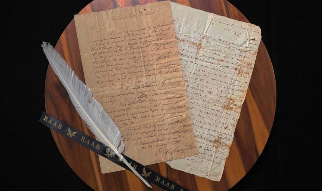
While awaiting reinforcements, Scott directed Lee and Major William Turnbull (who was chief topographical engineer) to make studies of approaches to Mexico City, collect information, compare notes, and then determine the best route the American army could take from Puebla to the capital. The officers accummulated intelligence from travellers, natives and written materials, and when settled as accurate the data was pencilled in on a map. Scott examined the engineers’ progress almost daily. Lee and Turnbull (with Scott monitoring) ended up mapping out a route from Puebla via the Prieto River over to Ayolta, then ending at El Penon, a scant 7 miles from Mexico City. El Penon was the gateway to the Halls of Montezuma, but it was believed to be a heavily fortified garrison. So at that point, in the field and with up to the minute information, it would be decided whether to attack it and thus try to go directly into the Mexico City or swing down below it and come up from the south. The Puebla-El Penon route being decided upon, Scott ordered that the data from the map be written down and a copy provided to his division commanders. These charts would serve as directions and also a scale of distances, which was necessary because Scott intended his divisions to leave Puebla on a staggered schedule rather than all at once.
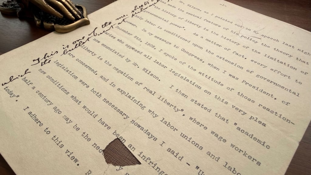
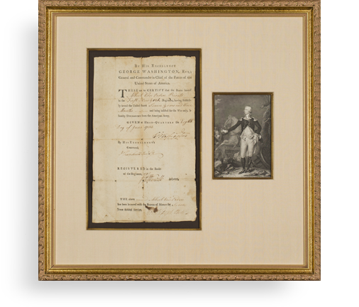
Autograph Document Signed, Puebla, circa July 1847, being General John A. Quitman’s copy of that very document. It is headed “Table of distances from Puebla to the City of Mexico.” It lists the stops on the entire route, and the mileages between them, plus the cummulative mileage of each from Puebla. By “authorities”?Lee means persons who were his sources of information; we know that Fitzwater was an army scout on the scene.
On August 7, General Franklin Pierce arrived at Puebla with a second contingent of reinforcements, 2500 in number. The American force was now sufficient for Scott to make a move. The advance commenced almost immediately, with Twiggs’s division in front. The remaining three divisions followed, with an interval of a day between. The marches were short, to make concentration easier in case of attack.
Reaching the outskirts of Mexico City on August 20, the Americans assaulted the town of Contreras, routing Mexican forces. Later that day, Scott attacked the Mexican lines at Churubusco. Fighting from behind convent walls, the Mexicans beat off repeated American assaults until their ammunition began to run out; then their line broke and they retreated. Now only five miles remained to Mexico City. On September 8 Molino del Rey was taken, and Scott now sought to take Mexico City itself. However to do so would require storming Chapultepec Castle, which was perched on top of a 200 foot hill and dominated the western defenses of the city. On September 12, the castle was taken and the Americans occupied Mexico City. The war was essentially over.
As for Lee, his twice determining the route for Scott’s forces to successfully maneuver around the Mexicans with minimum casualties brought him renown in the army and made him one of the most famous non-general officers of the Mexican War. When 14 years later the Civil War broke out, and Lincoln asked Scott who should command the U.S. armies in the field, Scott recommended Robert E. Lee. Virginia had seceded, however, and Lee declined the post. Instead he would go down in history as the legendary leader of the Confederacy.
Frame, Display, Preserve
Each frame is custom constructed, using only proper museum archival materials. This includes:The finest frames, tailored to match the document you have chosen. These can period style, antiqued, gilded, wood, etc. Fabric mats, including silk and satin, as well as museum mat board with hand painted bevels. Attachment of the document to the matting to ensure its protection. This "hinging" is done according to archival standards. Protective "glass," or Tru Vue Optium Acrylic glazing, which is shatter resistant, 99% UV protective, and anti-reflective. You benefit from our decades of experience in designing and creating beautiful, compelling, and protective framed historical documents.
Learn more about our Framing Services