


John Wesley Powell, the First White Man to Explore the Grand Canyon, Writes as Head of the U.S. Geographical and Geological Survey of the Rocky Mountains

An extremely rare letter of the great explorer who literally put the Grand Canyon on the map.
John Wesley Powell enlisted in the Union Army and was commissioned as captain. He lost his right arm at the elbow in the Battle of Shiloh but returned to active duty and was promoted to the rank of major. For the remainder of the war, while participating in actions such as the...

John Wesley Powell enlisted in the Union Army and was commissioned as captain. He lost his right arm at the elbow in the Battle of Shiloh but returned to active duty and was promoted to the rank of major. For the remainder of the war, while participating in actions such as the siege of Vicksburg, the Atlanta campaign, and the Battle of Nashville, he commanded artillery batteries under Gen. William T. Sherman and Gen. George Thomas and served on Thomas’s staff.
After the Civil War, the Federal government, wanting to demystify the West, made investigating, mapping and understanding the Western territories an integral part of its domestic policy. Powell got involved after he became curator of the Illinois Natural History Society Museum in 1867. Possibly with Sherman’s encouragement, he organized a specimen-collecting expedition to Colorado, where he climbed Pike’s Peak and explored the Rocky Mountains.
In 1868 Powell organized another expedition, this time to explore the Colorado River, starting with one of its tributaries, the Green River of Wyoming, then heading southward through Arizona. This was unknown, uncharted territory, and the fabled expedition would be the last great exploration of unknown territory in the continental United States. Powell’s 10-man party included hunters, trappers, and fellow Civil War veterans. They left Green River Station, Wyoming, on May 24, 1869, in four small boats that were not really suited for the long trip or the white water rapids to follow. The explorers made their way down the Green past Flaming Gorge, which they named. At Lodore Canyon, Utah, one of the boats sank in a rapid, taking with it scientific instruments and about one-fourth of the party’s provisions. The party recovered some of the barometers, however, which were used to measure cliff elevation.
The party entered the Grand Canyon, and history, on August 5, at a point that Powell named four days later, writing, “The walls of the cañon, 2,500 feet high, are of marble, of many beautiful colors, often polished below by the waves…. As this great bed forms a distinctive feature of the cañon, we call it Marble Cañon.” Ninety-nine days after they started, after one of the most daring journeys in American history, John Wesley Powell emerged from the Grand Canyon to become a contemporary American hero. In the end, only six of his ten men survived.
In the wake of his headline-grabbing, first expedition down the Colorado River, Powell was granted a Congressional appropriation to “complete the survey of the Colorado of the West and its tributaries.” He and a few others were at work in the field. By 1879 there were four different government agencies submitting maps and reports for the U.S. government: Powell’s U.S. Geographical and Geological Survey of the Rocky Mountain Region; the U.S. Geological Exploration of the 40th Parallel, led by Clarence King; the U.S. Geographical Survey West of the 100th Meridian, led by Lt. George Montague Wheeler; and the U.S. Geological and Geographical Survey of the Territories, led by Ferdinand Vandeveer Hayden. At Powell’s recommendation, in 1879 these were either concluded or consolidated under the newly created office of the U.S. Geological Survey, which was established by Congress on July 1, 1879, for “classification of the public lands, and examination of the geological structure, mineral resources, and products of the national domain.”
Clarence King was named director of the new U.S. Geological Survey, taking the position with the understanding that it would be temporary. He resigned after twenty months, and was replaced by Powell, who would head the organization for the next 23 years. The establishment of the agency was one of the most important achievements of Powell’s career. Over the next century the U.S. Geological Survey became one of the most well-regarded organizations of its kind. Today its many activities include predicting when earthquakes will occur, evaluating water quality and producing some tens of thousands of maps. In 1877 Powell published a pioneering work on Indian languages that led to his appointment in 1879 as the first Director of the U.S. Bureau of Ethnology of the Smithsonian Institution, a post held simultaneously while serving as the USGS director.
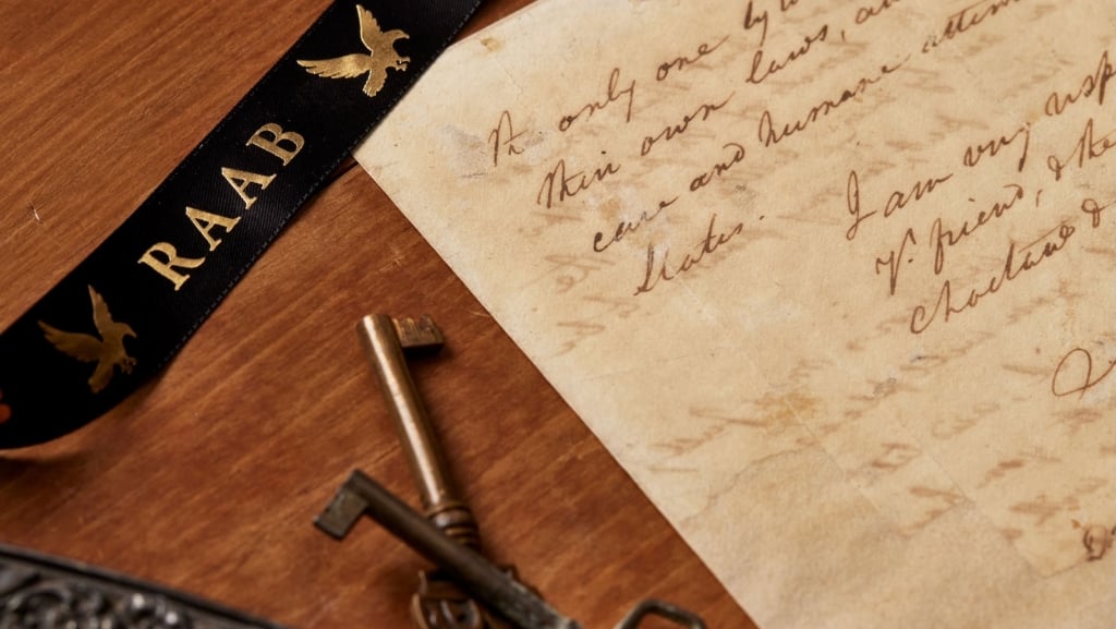
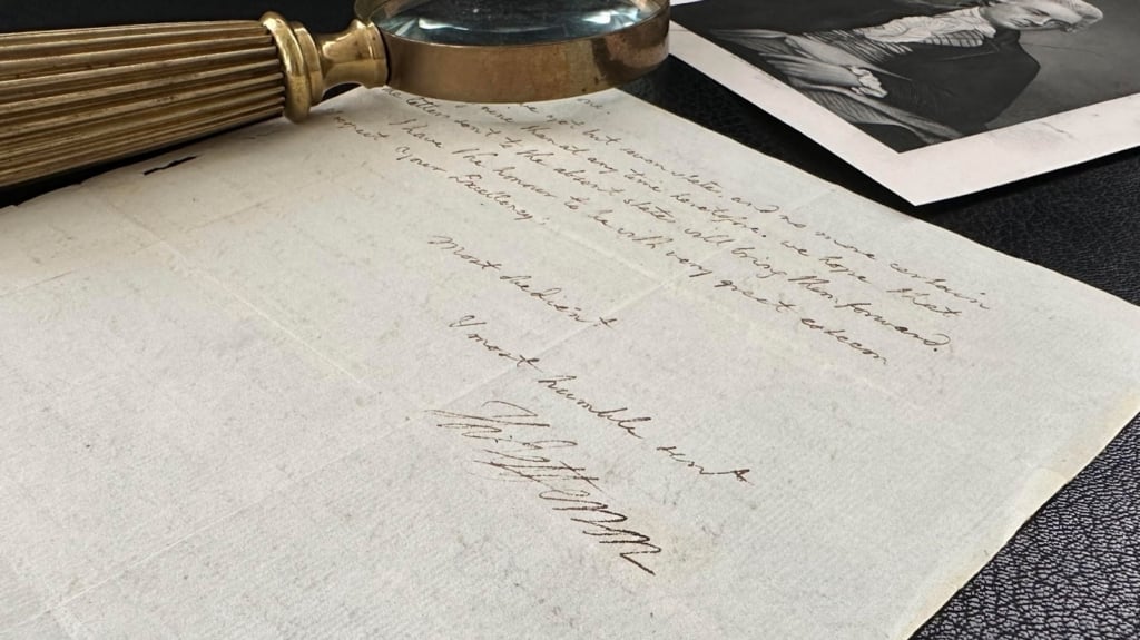
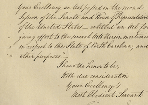
Letter signed, on his Department of the Interior, U.S. Geographical and Geological Survey of the Rocky Mountains Region letterhead, just months prior to establishment of the U.S. Geological Survey, showing him as “in charge”, Washington, March 1, 1879, to Adm. John Rodgers, who had won the Thanks of Congress for his service in the Civil War, and was then head of the U.S. Naval Observatory. “Mr. and Mrs. Paul of Vineland, N.J., at present in Washington on a visit, are anious to visit the Observatory during the evening if the rules permit. It would afford me much pleasure if you would give them the necessary tickets of admission.” The Paul mentioned was likely Chauncey Paul, noted horticulturalist of Vineland.
Letters of Powell are true rarities. A search of public sale records going back 30 years turns up none, and we can only recall seeing a handful over all these years.
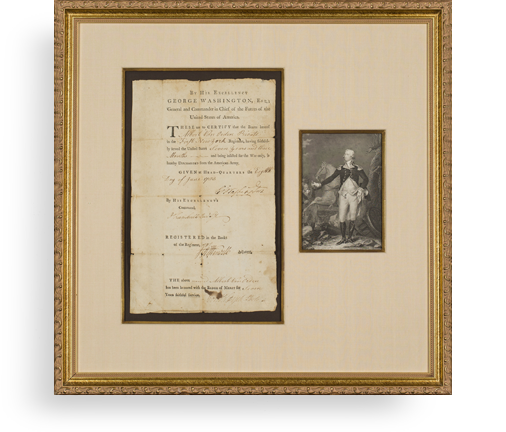
Frame, Display, Preserve
Each frame is custom constructed, using only proper museum archival materials. This includes:The finest frames, tailored to match the document you have chosen. These can period style, antiqued, gilded, wood, etc. Fabric mats, including silk and satin, as well as museum mat board with hand painted bevels. Attachment of the document to the matting to ensure its protection. This "hinging" is done according to archival standards. Protective "glass," or Tru Vue Optium Acrylic glazing, which is shatter resistant, 99% UV protective, and anti-reflective. You benefit from our decades of experience in designing and creating beautiful, compelling, and protective framed historical documents.
Learn more about our Framing Services