


The Settlement of William Penn’s Lower Colonies in the Early Colonial Era


Some of the earliest surveys of the region to reach market, plotted and signed by prominent surveyors to the Penn family
The archive, which was acquired from the heirs of the family, is evidently unpublished, and has never been offered for sale before
The English took control of what is today Delaware from the Dutch in 1664, and in 1682, William Penn, the Quaker Proprietor of Pennsylvania to the north, leased “the three...
The archive, which was acquired from the heirs of the family, is evidently unpublished, and has never been offered for sale before
The English took control of what is today Delaware from the Dutch in 1664, and in 1682, William Penn, the Quaker Proprietor of Pennsylvania to the north, leased “the three lower counties on the Delaware River” from James, the Duke of York (future King James II).
The Lower Counties of Delaware were governed as part of Pennsylvania from 1682 until 1701, when the Lower Counties petitioned for and were granted an independent colonial legislature; the two colonies shared the same governor until 1776. The English colonists who settled Delaware were mainly Quakers. Among these were the Brakin (Bracken) family and the Ball family.
Archive of approximately 100 pages, representing approximately 30 manuscripts, from 1702-late 18th century, more than half from the first half of the century.
There are 3 surveys from before 1715, including two dated 1702, right after the 1701 recognition of Delaware as an independent legislatively governed entity.
The archive, which was acquired from the heirs of the family, is evidently unpublished, and has never been offered for sale before, is a who’s who of early greater Pennsylvania and Delaware and the early surveying community in the region.
Selections:
George Dakeyne, surveyor of New Castle, appointed by the Penn Family

Autograph survey signed, George Dakeyne, no date but approximately 1702, survey of land in the Mill Creek Hundred, containing various properties and landmarks.
Autograph survey signed, George Dakeyne, January 22, 1713/4, survey of land in the Mill Creek Hundred, at the request of John Ball, his property, bearing landmarks and coordinates.
Autograph survey signed, George Dakeyne, January 12, 1702/3, survey of land of William Brakin, part of the Mill Creek Hundred, bearing landmarks and coordinates.

Benjamin Eastburn, surveyor general to the Penn family
Along with Noxon, created the earliest maps of the state of Delaware

Autograph letter signed, Benjamin Eastburn, surveyor general, March 23, 1735-6, accepting a survey of the land of John Ball into his property (survey above signed by Dakeyne).
George Stevenson, Deputy Surveyor under Nicholas Skull
Autograph survey signed, George Stevenson, May 28, 1746, a survey of the land of William Ball, and surrounding area, bearing landmarks and coordinates.
Autograph document signed, March 26-28, 1744, George Stevenson, James McMullan, John Gillahan, a fascinating early bill for surveying services, including for “2 chain-bearers”
Autograph draft survey, April 25, 1746, land of John Ball and environs, bearing landmarks and coordinates
2 autograph surveys, different plots of land, one signed, bottom panel separated, September 1744, land of Robert Kirkwood, bearing landmarks and coordinates.
Autograph letter and survey signed, September 30, 1743, survey of the Ball property, bearing landmarks and coordinates.
Large survey, biofolium, January 22, 1744, John Ball’s land, bearing landmarks and coordinates.
Thomas Noxon, surveyor of the PA government and later surveyor in Delaware

Along with Eastburn, created the earliest maps of the state of Delaware
Autograph letter and survey signed, August 23, 1740, survey of the land of William Brakin, bearing landmarks and coordinates.
Beginning in the 1770s, the families attempted to get approval for the construction of roads. There are surveys and official documents relating to this effort. Some are signed by Quaker and Delaware figure James Booth.
Autograph survey signed, Peter Hyatt, February 9, 1796, survey of the land of Henry Brackin, and others, bearing landmarks and coordinates.
Autograph survey signed, for a private road to the house of James Ball. With an autograph letter signed, certifying that they have inspected the area and approve of the road, signed by Joseph England, Abraham Holmes, John Viven, John Reece. Certified by John Burn.

2 Surveys of proposed road, 1788, attached to a report of the property and proposed road, signed by Robert Crawford, George Reynolds, and George Grubb.
Autograph document, August 1770, an official copy of a resolution for a private road on the land of John Ball.
Autograph document signed, May 19, 1783, William Robeson, John Hendrickson, Andrew Yeatman, Samuel Camble, and Joseph England, report of inspection of the area and approval of the road on the Brackin property, along with a note by the Delaware government, signed by James Booth.
Document signed, bearing state seal, James Booth, April 1788, an order to inspect and possibly build a road on the Brackin property.
Autograph letter signed, James Ball, May 1799, to the Judges of the Court of General Sessions for Newcastle County, requesting a road be built on his property to connect his land to his neighbors and the public road.
Document signed, bearing state seal, James Booth, February 1789, an order to inspect and possibly alter a public road connecting with Newark.
Document signed, bearing state seal, James Booth, May 1789, describing the layout of two roads in the Mill Creek Hundred.
Copper – there are two documents that relate to a copper mine in New Castle County

Autograph survey unsigned, no date, but perhaps around 1735, a survey of the land of William Brakin and others, with the intent of showing the location of a copper mine.
Autograph note signed, April 4, 1744, referencing the existence of a copper mine near William Ball’s property.

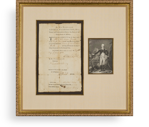
Frame, Display, Preserve
Each frame is custom constructed, using only proper museum archival materials. This includes:The finest frames, tailored to match the document you have chosen. These can period style, antiqued, gilded, wood, etc. Fabric mats, including silk and satin, as well as museum mat board with hand painted bevels. Attachment of the document to the matting to ensure its protection. This "hinging" is done according to archival standards. Protective "glass," or Tru Vue Optium Acrylic glazing, which is shatter resistant, 99% UV protective, and anti-reflective. You benefit from our decades of experience in designing and creating beautiful, compelling, and protective framed historical documents.
Learn more about our Framing Services


